Sunday November 7, 2010
 |
| My campsite for the night, just off Maria-Theresien-Straße in Kottingbrunn, Austria. |
I wanted to get an early start again but it was really hard to get up early after several days of sleep deprivation at the hostel, and the previous week while I was cycling 200 km per day. So I woke up at 7:30 and discovered I was still in slow mode, I didn't get on the bike until after 9, and then my pace was pretty slow as well. I took the whole day a bit casually I think. During my 200 km/day period, I'd been in highly efficient mode, but the few days in the hostel had put me firmly back into inefficient mode.
 |
| Riding alongside a canal just past Tritolstraße, between Theresienfeld and Eggendorf, and heading towards Wiener Neustadt, Austria. |
And I kept getting held up by people trying to help me but really they weren't much help. First it was a fairly old couple; the man was doing all the talking because his English was better. He asked me where I was going, "Graz", I told him. Then he spent about 20 minutes explaining to me how to get there using the map on the iPhone, right down to the details like "...then go straight through the round-about there", even though the route was mostly already marked out: EV9 and R5, and I was confident I'd have not trouble following it, but I didn't want to be rude and so he wouldn't stop giving me directions. And it was apparent he wasn't experienced with using the iPhone, he would push on the screen really hard to move the map around, when you actually only need to touch it lightly, and it works better that way.
Then just a few kilometres up the path I stopped because I had to make an important decision: my map said the EV9 route went right, while the sign indicated it went left. I guessed that they had recently changed the EV9 route to this new route, but it hadn't been updated on my map yet. I really could have gone either way, but eventually I decided, after my experience with trying to follow a bike route without the route being marked on the map and getting lost, to go with the old route which was marked out on my map.
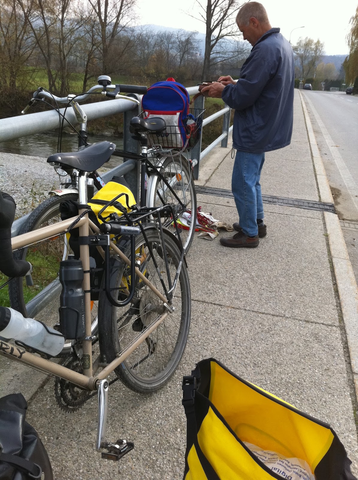
Then I noticed that one of my rear brake pads was missing. I looked around and there it was lying on the ground. It must have fallen out because the pin fell out. There was a middle aged bloke nearby who noticed I had a problem, but he couldn't speak English.
 |
| A man who stopped to try and help me with a mechanical repair, on Ofenbachstraße, Lanzenkirchen, Austria. |
So I tried to show him what the problem was, that I needed a pin to hold the brake-pad in. He saw my problem and went back to his bike for his tool kit. He pulled out a pair of pliers and tried to squash the brake pad encasing so that the brake pad couldn't slide out again. It didn't work.
Then he unscrewed the brake pad and turned it upside down, which just meant the brake pad would slip out the opposite direction instead, braking in forward motion rather than braking in backward motion. He kept saying "moment moment" and "OK". I think these were the only English words he knew!
I managed to find a spare pin in my puncture repair kit, so I inserted it and it was fixed! I thanked the man for his attempts to help, and kept going.
 |
| Looking towards the mountains I was approaching, some of which were snow-capped, from Ameisbachgasse, near Neunkirchen, Austria. |
 |
| Following a bike path beside Siedlaustraße, near Siedlau, half way between Ternitz and Gloggnitz, Austria. |
 |
| At the train station in Gloggnitz. I wasn't catching a train, just checking the station out, and finding a toilet. Spotted this very long freight train loaded up with hundreds of cars. |
Forty kilometres later, I hit my first real hill for a long time - the mountain pass before heading down into Graz, peaking at 970 m. I'd thought it was going to be hard, and I was mentally prepared for it to be a tough climb, but it was a piece of piss.
I was really impressed by this bridge on the way up:
 |
| On Schottwien, approaching Im Himmelreich, at the base of the climb, with the Semmering Schnellstraße (Mautstraße) passing overhead on an impressive bridge called the Talübergang Schottwien. |
 |
| Talübergang Schottwien, 632 metres in length and one of the largest pre-stressed concrete girder bridges in the world, and is 130 metres high. |
 |
| Another view of Talübergang Schottwien as I climbed the road (Göstritz). This shot is from near Maria Schutz. |
The descent was pretty chilly though.
 |
| Starting the descent on Bundesstraße at a cool 8°C after passing through Semmering, Austria. |
I was still holding onto my goal to make it to Graz, but as I slowly progressed, and it got dark, I realised I wasn't going to make it there in time :( It would be after midnight before I made it there, so I stopped in a little town and found a spot to camp under an apple tree at about 10 o'clock, some 50 km from Graz.
 |
| My route for the day, Kottingbrunn to Pernegg, Austria. |
 |
| An overview of my route so far, France to Austria. |
Ride stats:
Distance: 151.50 km
Average: 19.8 km/h
Maximum: 44.4 km/h
Time: 7:38:36
Total ascent: 1079 m
Total descent: 888 m


No comments:
Post a Comment