Sunday September 19, 2010
 |
| My campsite for the night in Machynlleth, in amongst some tree shelter |
It was still raining lightly when I left. As I was heading out of the town, I noticed a blue and red "Cycle Network" sign, designating a "route 8". Now I've actually seen quite a few of these in my travels so far, even followed some of the routes for a bit, but not knowing what they're all about, so I decided it was time to investigate, and I looked it up on the internet on my iPhone.
As it turns out, there is a whole network of cycle routes across the UK. Why didn't I know about this earlier?! I downloaded a map of the network right away, and route 8 actually took me in the direction I wanted to go, but along a quieter, designated cycle route. So of course I took this route, and used the map that I had downloaded together with Google Maps with its GPS to determine exactly where I was.
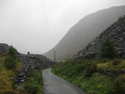
There was a lot of climbing up narrow roads to start with, I think I must have been heading up a mountain range! It was raining the whole time and I was drenched, but not cold, I was actually sweating at the same time from all the climbing. The scenery was good though.
 |
| A mountain stream. |
 |
| Mountain fog. |
 |
| A narrow road through heaps of basalt. |
 |
| A basalt wall. |
 |
| Lots of basalt. |
 |
| Mullock heaps. |
 |
| A fence made of wire and basalt. |
However, I was more concerned about the descent, because I didn't think my brakes would be up to the task.
 |
| A little mountain stream. |
 |
| Near the top of a particularly steep section. |
 |
| Plenty of water running down the road! |
 |
| Hey there little matey! |
 |
| A street in Dolgellau |
From Dolgellau, there were a few cycle network routes I could take. I opted for the coastal route, figuring that it would be less hilly. This turned out to be a good assumption, there was a flat path all the way to Barmouth, called the Mawdacch Trail, and is part of the Sustrans Cross-Wales Cycling Route.
 |
| The river Mawddach. |
 |
| Just south of the river Mawddach. |
 |
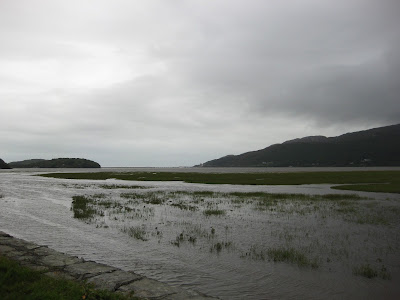
| Mawddach estuary |
 |
| Mawddach estuary, which was a great centre of ship building back in the 18th century. |
 |
| Crossing the rail bridge to get to from Morfa Mawddach to Barmouth, south to north. |
 |
| The rail bridge crossing the Mawddach estuary, looking south where I came from. |
 |
| Barmouth |
 |
| Looking out towards the ocean in Barmouth. |
 |
| On my way again, heading North along the coast. |
So I continued along the Sustrans National Cycle Network Route 8, which went along the coast to start with (fairly flat), then cut across inland at which point it became very hilly. As I continued to follow this route, using the low-res cycle network map I'd downloaded earlier, and in complete foggy darkness, the roads started becoming narrower and rougher. I hadn't seen a route 8 sign for quite some time, I wasn't sure whether I'd just been missing them because it was dark, or whether they were missing. I went past what must have been a reservoir (couldn't see it on the map), then through a few gates, and the road became more of a driveway, then it eventually became a dead-end, at an old stone building.
At this point, I knew I was lost; I must have missed a turn somewhere. It's kinda scary being lost in the dark in a foreign country on your own, when no one knows where you are. Google Maps showed my position, but it didn't show any of the roads I'd just been on, it was all just green. It couldn't get more detail because I had no phone network coverage. It was about 9 o'clock and I was getting low on energy and thirsty because I'd run out of water. My only option was to retrace my wheel tracks, and either try to find a route 8 sign, or take a turn off that looks like it heads in the right direction.
I rode back and came to a little intersection with a small road branching off to the right, with a sign that warned the road was narrow with few passing points.
The road showed up faintly on Google Maps, and I could see that I could use it to get to Penrhyndeudraeth, so I took it.
It seems the smaller the road, the steeper and winder it is. This one was very steep, it had switchback after switchback, and gates in inconvenient places, with sheep along the way, still raining on and off. I got so sick of opening gates!
At one point I was riding down a little hill when all of a sudden I was in water! Turned out there was a massive puddle over the road that I didn't see. I instinctively tried to pull my feet up, but they were clipped in to the pedals, so they got filled with water again. Didn't matter I suppose, my feet had already been wet all day. Momentum carried me through the puddle.
With all the climbing I'd done, I knew there must be some mean descents coming up, and again I was scared because of my crap brakes. A few times I thought "this descent is too good an opportunity to be going slow, so I let go of the brakes and built some speed up. As soon as I had, there was an unexpected sharp 90 degree bend, I braked hard and almost didn't make it, almost collided with rock. Undeterred, I soon got some speed up again, rounded a bend and all of a sudden there's a gate right in front of me! Braked hard and almost collided with it. "Okay, that's enough of a deterrent, better take it slower", I thought, because you never know when a gate's going to jump out in front of you, or a sheep, or a rock, or an unexpected tight bend.
I felt the rims after some hard braking on a descent, they were too hot to touch! You have to be careful with this because if you're braking hard down a descent, the rims can sometimes heat up so much that they melt the tyre and the tyre explodes.
I crossed another long bridge, which was meant to cost £1, but being late on a Sunday night of course no one was manning this one either.
 |
| Looking back after crossing another long bridge. |
Then I heard a couple of diesel 4WD engines. This is the sound you often don't want to hear when you're camping, because it signals either a ranger, a caravan park manager, a sports ground manager, or someone else of authority. In this case, a couple of 4WD's drove into the ground, they hopped out and called out to me in an unfriendly tone. They walked over to me and asked what business I had there. I said I was looking for a camping ground. One of them said "well this isn't a camping ground. And you can't walk on this ground, we don't want it disturbed," etc.
"Yeah I know, that's why I only walked around the outside of the ground. Do you know if there are any camping grounds around here?"
"Yeah, there's a caravan park just up the road."
I don't know how they knew I was there at 11 o'clock on a Sunday night, and how they got there so quickly, I guess they must have been watching a CCTV camera. I couldn't believe they found me there and came and kicked me out though, who would have thought? They must really care about their sports grounds, full credit to them. It was fair enough, I was in the wrong, but still, I was surprised.
After this, I really couldn't be bothered trying to find another free place to camp, I just wanted to sleep, so I rode to this caravan park just down the road, and set the tent up there.
I've had to ask myself a few times, why do I always end up riding at night? It has its obvious disadvantages, you can't see the scenery, and as I discovered tonight, navigation is more difficult. It's also much more difficult finding a good camping spot in the dark, as well as setting up the tent, and usually it pushes the whole sleeping pattern back so that I wake up late morning, get going early afternoon, and because I feel like I haven't covered many kilometres by the time it gets dark, I always want to keep riding and get to my target town. I tend to be fairly optimistic with how far I want to go each day, I've been hoping to cover over 100 km each day, because I know there's so many places I want to go in Europe, and I'll have to ride that sort of distance each day to see them all. But the way I should be doing it is by getting up early, riding during daylight, setting up the tent at dusk and then getting an early night, to repeat the process. It's funny though, I've noticed I often feel the best on the bike at night time, after about 7 pm for some reason I start feeling really good, whereas in the morning I feel a bit slow and less motivated. Riding at night also means there's generally less traffic out on the roads, so it does have its benefits.
This does mean though that I have some photos missing from my travels, because I don't have photos of all the areas I've been passing though at night. There are also other situations where I'm missing photos: when I'm going downhill and don't want to stop, because it's a lot of momentum to be stopping. Also when it's wet and cold, my hands are numb and I can't be bothered getting the iPhone out. Don't want it getting wet either. I'd also be missing a few photos from when the iPhone battery is flat, which has happened on just a few occasions so far.
I was pretty hungry when I got to the caravan park, and since there was a sink and water and lights there, I decided I'd get the Trangia out and cook some pasta.
 |
| A late dinner of trangia-cooked pasta. |
I went to sleep at about 2am, what a tiring day!
Ride stats
Distance: 92.7 km
Average: 14.4 km/h
Maximum: 47.8 km/h
Time: 6:26:00


No comments:
Post a Comment