 |
| Breakfast beside my tent. |
I wasn't feeling that great on the bike today though, a little slow. And the weather wasn't great either, wet and showery.
 |
| Crossing the Menai Suspension Bridge, heading towards Bangor on north-west Wales. |
 |
| Riding along the coast in north-west Wales. |
 |
| Even their bike path walls look like the top of a castle turret. |
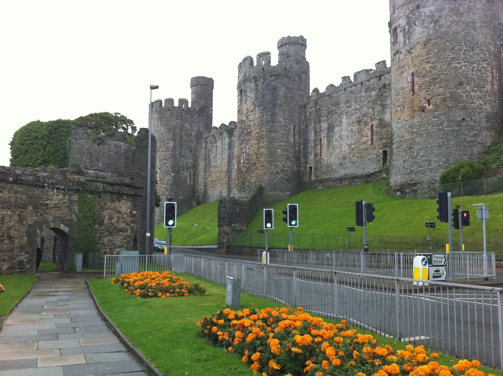 |
| Conwy Castle |
 |
| Looking back towards Conwy. |
 |
| Fixing puncture number 2 for the trip. |
First I was using the GPS app TomTom, which cost $120 from the app store, probably the most expensive app going 'round, and I only used it for the first few days. After London I was just using Google Maps, and having the internet on the go means I can get more detail in the maps as I go along as required. Then I was using the National Cycling Network map, in combination with Google Maps. But now with this app, I can see the National Cycling Network routes on a Google Maps style interface, which I can zoom in or out on, and unlike Google Maps, it shows me contours! I've been thinking for a while this is what I really need, because following the cycle network map and Google Maps, I really have little idea of what the terrain will be like, other than by actually looking in the direction I'm heading, and assuming that if I see mountains ahead, then it's going to be hilly. This "Bike Hub" app also utilises GPS and shares characteristics with apps like TomTom. You enter in the destination you want to go, select "fastest route", "quietest route", "shortest route" or "balanced route", and it works out a route for you, outlines the route on the map, and can give you directions if you want it to. So I've been using that, and I can choose whether to take the route that it recommends, or to take a cycle network route instead (if the app doesn't recommend taking the cycle network route), or I can take whichever route I like, and still see in the Bike Hub app map the roads that I'm on with the blue dot representing my location via GPS and the contours I'm about to traverse. So I think this is the superior navigation method for the UK. I'll have to revert to the old method once I'm out of the UK again though.
Anyway, there I was fixing the puncture in the rain. This took more than an hour all up, I really wasn't happy about getting a puncture, I was feeling a bit flat and unmotivated but I thought "well, it's the first one the tyre has had, it was bound to happen sooner or later, it's just unlucky, fix it and move on." So I fixed it and moved on.
Next I got to a town called Colwyn Bay, and stopped by the beach side for lunch (rolls with tomato and sardines).
 |
| Colwyn Bay |
 |
| Colwyn Bay |
 |
| Roy's house in Colwyn Bay. |
 |
| Roy with his son on the left. |
The blokes name was Roy, and his wife's name was Pauline, they would have been in their early 60's I guess, very friendly people too. They were both "born and bred" in Liverpool, and one of the reasons they moved to their current location in Wales was so that they could cycle along the cycle path which runs right along the north coast there for 15 odd miles to Prestatyn. I also met their son Mark, 22 year old bloke; he was just about to head out to a mates place.
I had a few cups of tea and some delicious quality fruit cake (Roy reckoned he always likes to get good quality food).
 |
| Tea and fruit cake. |
They also talked a lot about places they had been, both driving trips and cycling trips, and how Pauline was also into kayaking (don't get the wrong idea though, she wasn't slim, young, fit and into extreme sports, I imagine her kayaking would have been rather slow and tame). Interestingly, Pauline had relatives in Fremantle, Western Australia. It seems like a lot of people I talk to over here have relatives in Australia.
Roy was kind enough to give me some left over roast turkey on my departure, that I could use for lunch the next day. By the time I left their place it was just about dark. It wasn't much further down the road that I got my second puncture for the day! I couldn't believe my bad luck. Quite annoyed, I stopped under a bridge (it was still raining), ate some roast turkey sandwiches (I was too hungry and annoyed to save it for the next day) and fixed the puncture, and I was on my way again.
 |
| Repairing puncture number 3 for the trip. |
This third puncture I couldn't be bothered fixing, it was dark, raining and getting late. It was a slow enough puncture that I could keep going for a while before it was too flat to ride though.
After riding through more rain, and very sandy paths that clogged up the drive-train, I finally made it to Prestatyn, found a spot of grass to camp on near the sand dunes, set up and collapsed into my bed.
Ride stats
Distance: 76.68 km
Average: 15.9 km/h
Maximum: 44.7 km/h
Time: 4:48:41
No comments:
Post a Comment